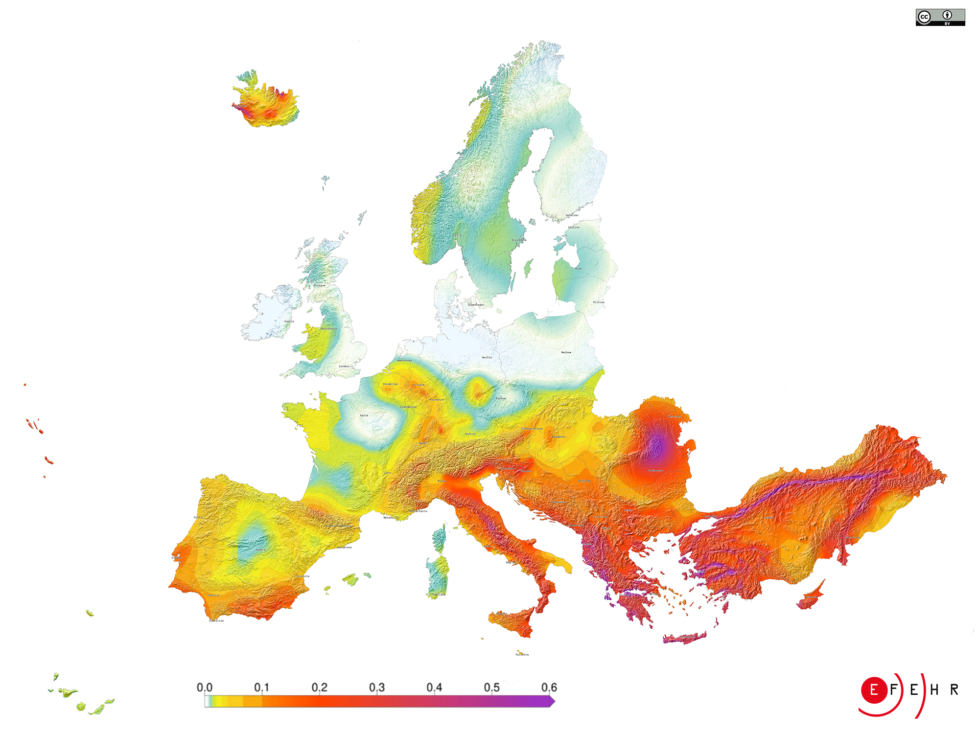
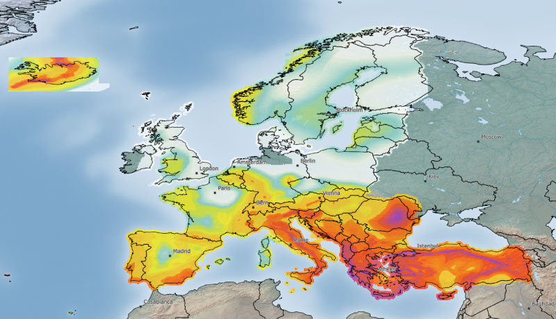
The earthquake hazard map of Europe

The earthquake hazard map shows the expected level of ground shaking at a specific location due to future potential earthquakes that might occur locally or at a greater distance. Ground shaking is expressed as Peak Ground Acceleration (PGA), normally given in the percentage of "g", the Earth's gravitational acceleration. The values displayed on the earthquake hazard map of Europe are based on the calculations of Europe's updated earthquake hazard model (ESHM20).
How to read the earthquake hazard map of Europe
Low hazard areas are coloured in white to green, moderate hazard areas in yellow to orange and high hazard areas in dark red to purple.
According to current design codes, earthquake-resistant residential or office buildings are designed to withstand expected ground shaking levels with a 10% probability of being exceeded in a specific time interval (i.e. 50 years). This is the average expected lifetime of a standard residential building and can also be described as the ground shaking that is expected to be exceeded every 475 years (the so-called return period of the hazard).
What does the earthquake hazard map of Europe tell us about different regions?
Turkey, Greece, Albania, Italy, and Romania are the countries with the highest hazard in Europe, followed by the other Balkan Countries.
However, earthquake hazard is also considerable in some regions of Austria, Belgium, France, Germany, Iceland, Norway, Portugal, Slovenia, Spain, and Switzerland. But even in regions with low or moderate seismic hazard, earthquakes can occur at any time.


