What is earthquake hazard?
Earthquake hazard, also referred to as seismic hazard, describes what level of ground shakings at the earth’s surface is expected due to potential future earthquakes. Ground shaking is the most relevant effect of an earthquake; however, it may also trigger secondary phenomena such as tsunamis, landslides or rock falls.
Earthquakes have a great potential for causing damage to buildings, the environment and people’s well-being. The location and frequency of earthquakes cannot be precisely predicted; however, thanks to robust earthquake hazard assessment, we gain an improved understanding of how often and how intensely the earth could shake in the future at a given location. It also sets the basis to efficiently tailor mitigation measures to make communities more resilient to future earthquakes.
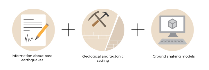
Earthquake hazard assessment is based on knowledge of past earthquakes, geology, and tectonics and takes into account various factors that may affect the strength of the shaking at any given location.
How to compile earthquake hazard?
To assess earthquake hazard, scientists try to envision and model where and with what magnitude earthquakes will occur and how the ground shaking caused by these earthquakes can be described. This is done based on available data sets and information on past earthquakes, geology and tectonics, and also considers the various factors that may affect the strength of the ground shaking at any given location. Recent scientific knowledge and research results are also required in order to reliably predict ground shaking. Dataset representing these factors are combined into earthquake hazard models used to estimate where earthquakes of different sizes may occur, how frequently they occur, and how probable certain levels of ground shaking due to earthquakes are.
Europe’s current earthquake hazard model
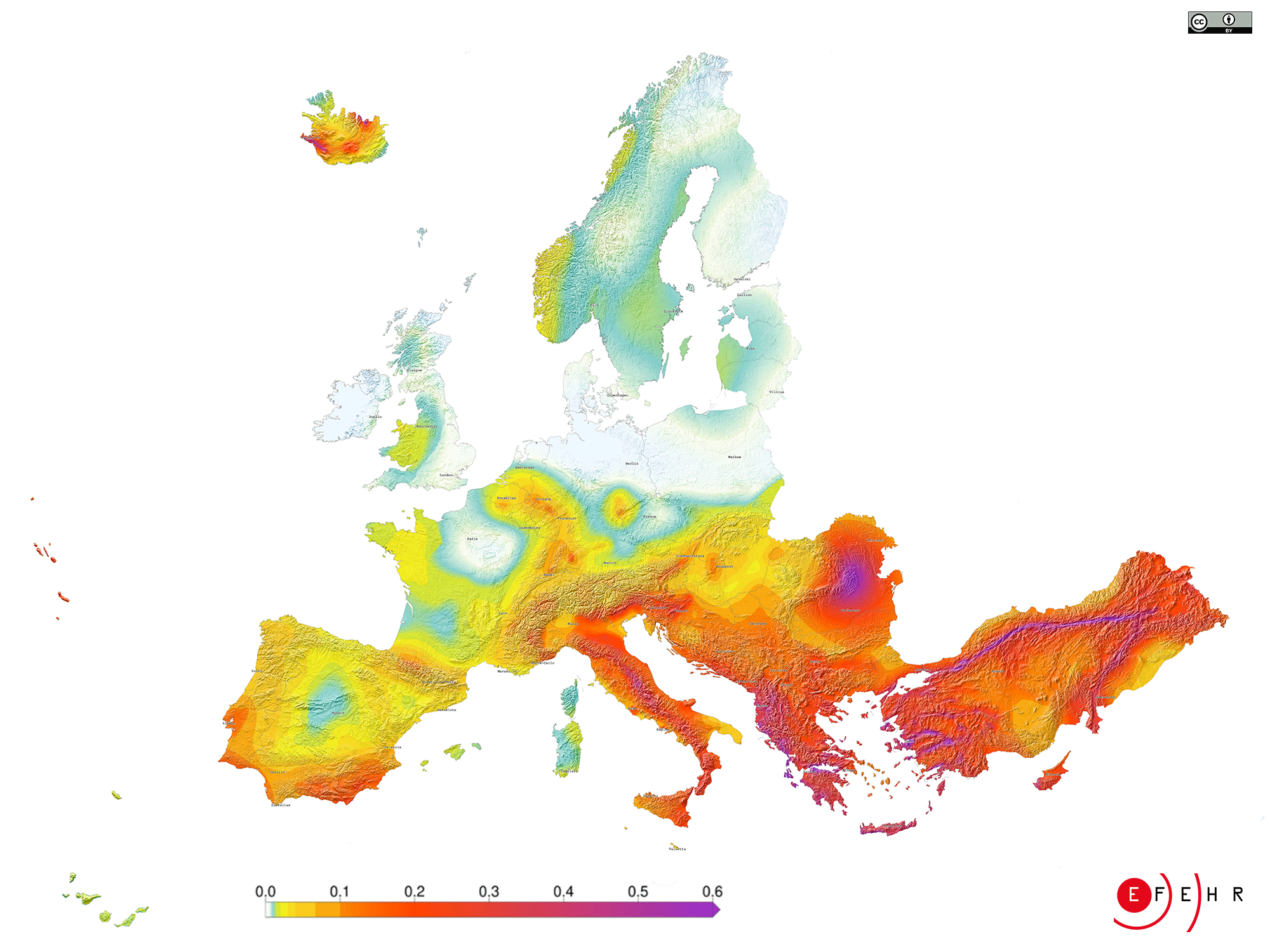
The current earthquake hazard model of Europe is the "2020 European Seismic Hazard Model (ESHM20)", which replaces the previous model of 2013 (The 2013 Euro-Mediterranean Seismic Hazard Model, ESHM13).
Significant effort has been made to harmonise and considerably extend these datasets of the main underlying components for the updated version, resulting in more comprehensive estimates of ground shaking levels in Europe:
- Thousands of earthquakes have been added to the earthquake catalogue, which now covers a wider range of magnitudes and includes an additional 1,000 historical events.
- Researchers added about 1,200 active faults to the active fault database, spanning over 90,000 km of mapped faults.
- New ground shaking models have been developed for Europe through the newly compiled recordings of strong ground shaking and enhanced metadata of 25,000 waveforms.
- State-of-the-art seismogenic source models capture the spatial and temporal pattern of earthquakes across Europe.
- Finally, researchers applied the most recent scientific knowledge to combine these datasets into computational seismic hazard models leading to an updated hazard model for Europe.
What can we learn from Europe's earthquake hazard model?
In science, models enable calculations to be undertaken to determine how something might develop in reality, e.g. the level of ground shaking due to earthquakes at different locations. Thus, earthquake hazard models are the basis of any mitigation decision aiming at reducing the potential effects of earthquakes and is, therefore, a prerequisite for assessing earthquake risk.
1) We can support the definition of effective transnational mitigation strategies.
Most European countries routinely conduct, update and publish earthquake hazard models at the national level. Such models, when available, provide authoritative information to inform national, regional and local decisions related to developing seismic design codes and risk mitigation strategies. However, the underlying datasets of neighbouring countries are often not constructed consistently.
An example is the varying treatment of uncertainties which can lead to inhomogeneous hazard assessments, making it difficult to use seismic hazard estimates across borders. Europe's updated earthquake hazard model is again fully harmonised across borders and offers comparable information, crucial to establishing effective transnational disaster mitigation strategies.
2) We can set new standards for the construction of buildings to make them more resilient against future earthquakes.
Earthquake hazard models are primarily used in drafting seismic provisions. In Europe, Eurocode 8 are the standards recommended for earthquake-resistant construction and retrofitting buildings and structures to protect human lives, limit damages, and maintain functionally important civil protection structures.
Specific hazard maps from the 2020 European Seismic Hazard Model serve for the first time as an informative annexe for the next version of Eurocode 8 to support the definition of seismic actions. Integrating earthquake hazard models in specific seismic design codes helps ensure that buildings respond appropriately to earthquakes. Note that the earthquake hazard values must always first be translated into the standards for earthquake-resistant design and cannot be used directly as a basis for construction.
3) We can assess earthquake risk and other secondary phenomena triggered by earthquakes.

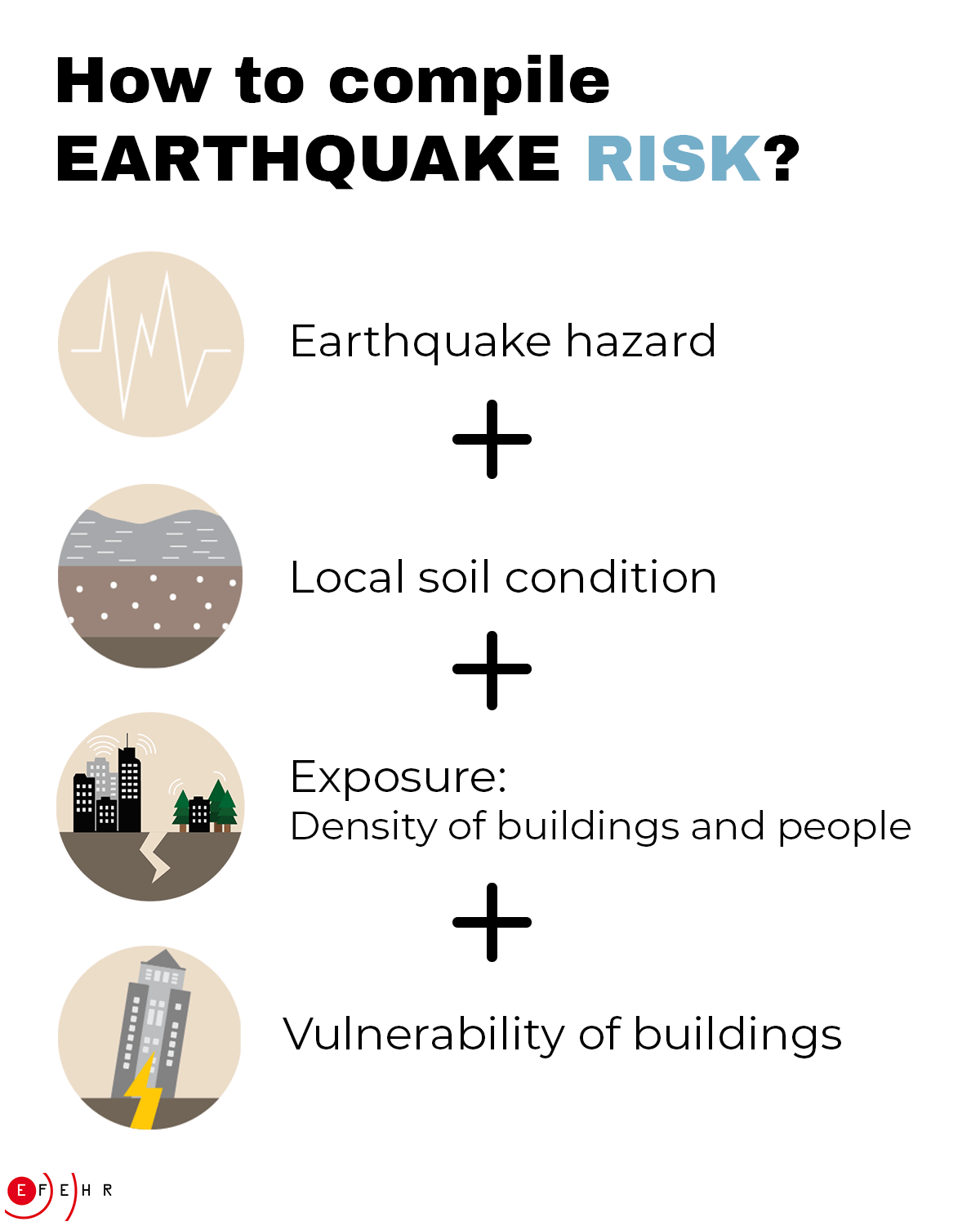
Information on earthquake hazard are essential to assess earthquake risk, which provides an estimate of the potential impact of future earthquakes on the built environment and on people’s wellbeing. In 2021, the the first fully open access earthquake risk model of Europe of its type became available.
The earthquake risk model combines information on local soil conditions, models for estimating economic losses and loss of life under increasing levels of ground shaking (vulnerability), and the spatial density of buildings and people (exposure) with ground shaking information derived from the updated earthquake hazard model of Europe.
Furthermore, information about earthquake hazard can be used to examine other hazards triggered by ground shaking, such as landslides, rock falls, or tsunamis. For this purpose, the openly accessible earthquake hazard model for Europe can be optionally supplemented with additional datasets.


